


........"The Conecuh National Forest in southern Alabama covers 83,000 acres (340 km²), along the Alabama - Florida line in Covington and Escambia counties.[1] Topography is level to moderately sloping, broad ridges with stream terraces and broad floodplains.
The Conecuh Trail winds 20 miles (30 km) through Alabama's coastal plain. The trail was built by the Youth Conservation Corps. Each year, beginning in 1976, the young people of the Corps extend the trail through park-like longleaf pine stands, hardwood bottomlands, and other plant communities of the Conecuh National Forest.
The name Conecuh is believed to be of Muskogee origin. It means "land of cane," which is appropriate because the trail runs through canebrakes in several sections.
Situated just above the Florida panhandle, the forest has a distinct southern flavor of mist-laden hardwood swamps, pitcher plant bogs, and southern coastal plain pine forest. These hilly coastal plains are also home to longleaf pine, upland scrub oak, and dogwood, as well as an aquatic labyrinth of winding creeks and cypress ponds.
Clear-cut in the 1930s, the Conecuh was reforested with slash pine that reduced the number of nesting trees for the endangered red-cockaded woodpecker. The forest is currently undergoing a reforestation from slash pine to the native longleaf. In time, this should increase the number of red-cockaded woodpeckers as the trees mature.".........
The end of March in this part of the country sees spring time early. The dogwood and azaleas were already in bloom and the birds and the bees, as well as all the other animals, were doing their spring time activities. Since we arrived on a Monday, the Open Pond Recreation Area campground was just about empty. Only three other RVs filled the seventy-three camp sites. Needless to say it was very quiet. The four days we spent there was very relaxing with daily walks on the trails, reading and playing with the boys. Finally, some down time.

Our next stop was another National Forest campground. Traveling a bit farther west into Mississippi, we stopped for another four days at the Desoto National Forest's Big Biloxi campground. Unlike the previous campground, this one was located close to major cities and busy highways. We decided to explore this area since we had been here before.
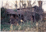
The countryside north of the Gulf was very impoverished. Not much to see or do outside of the cities of Gulfport and Biloxi. They, as the towns to their west along the coast, are still recovering from Hurricane Katrina Beach front property all along this section was completely destroyed. In many places the destruction went back from the coast by almost a half mile. Many have rebuilt or are in the process of rebuilding, but there are a lot of empty lots where homes and business once stood that now stand empty.
The beaches along this stretch of Gulf coast are beautiful and people were taking advantage of the warm waters and weather. We wanted to get a bit closer to the beaches on our next stop so we decided to stay for a week at the Navy's Construction Battalion (SeaBee) Base located in Gulfport, Mississippi. It was less than a mile from the coast.
1 comment:
In Pascagoula, the destruction went inland more than a mile. My brother had 18 inches of water in his house.
The house my parents used to own 4 blocks inland from the Gulf was gutted, declared condemned, and reburbished. The neighbors across the street? The house was gone. The slab remained.
Driving along the coast in October 2005 was devastating to see. I imagine it's even worse to see today, so long after the storm, and realize the long term impact these storms have on the areas they hit -- it's nightmare for the residents long after the media departs and moves on to the next story.
Post a Comment