As with the previous two stops our stop here will be brief. Our goal is to visit both Zion Canyon and Bryce Canyon National Parks. We decided to do both in one day since they were relatively close to one another so we started out early for Zion Canyon.
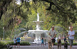
Zion Canyon National Park is located near Springdale, Utah and was about 40 miles from our RV park. The drive there was scenic as is most places in this part of the country. As we approached the Visitor's center we notice a very large parking area almost filled to capacity and wondered what was so interesting in there. We did not stop, however, and continued on the scenic drive until we came upon a closed gate at an intersection. The closed gate was the road leading into the canyon and was available to the park's shuttle buses only. Seems that during late March through early November the scenic drive through the canyon is closed to vehicular traffic and is only accessible on foot or the parks free shuttle buses. I looked into the shuttle bus schedule and found there was a two hour wait and no pets were allowed. Since this was an extraordinarily long wait and our boys were with us we were out of luck for the trip through the most scenic part of the canyon. Bummer.
 |
| Road leading into Zion Canyon. |
 |
| Zion Canyon in the distance. |
 |
| This is not snow or dust on the lens, it is the seed of the Cottonwood tree being carried by the breeze. |
|
Oh well. On to Bryce Canyon National Park. We started out of Zion Canyon on the
Zion-Mount Carmel Scenic Drive. Shortly after leaving the canyon floor the road started to get narrower and we noticed the obvious lack of guard rails. Thankfully, we were on the inside of this two lane road for my dis-like of high places would have made me turn back. Continuing we soon approached the
Zion Tunnel. This is a very narrow tunnel that stretches for one mile through the canyon walls. The tunnel only allows vehicles of 11'4" in height to pass two ways. If over that the rangers stop traffic at both ends and the vehicle must travel in the center of the road to pass safely through it.
 |
| Leaving the canyon floor on the Zion-Mount Carmel Scenic Byway. |
 |
| Rest/stretch/investigate stop. |
 |
| Rock climbers paradise. |
 |
| Ranger station at the tunnel. We were stopped here for 20 minutes while large vehicles came through from the other side |
 |
| Entrance to the mile long tunnel. |
The tunnel exits with an astonishing view of the valley below and, again, terrifying drop offs, some close to 3,000 feet, sans guard rails. Again, we are on the inside, but it was still nerve-racking, at least for me. It's almost like driving on the rim of the Grand Canyon. We will NOT return this way, however, this was the most beautiful and interesting section of the byway. There were many beautiful and interesting rock formations we have not seen anywhere on our journeys. We could, actually, spend days here hiking and photographing the formations.
 |
| Part of the rock formations called the Beehives. |
Bryce Canyon is about 90 miles from Zion Canyon, but the trip on Utah Heritage Highway 89 took us about three hours due to the many picture taking stops. This area was so different than the arid environment of the Hurricane/St. George area. This area was lush with green grass and trees. Hollywood discovered this area in the late 1930s and many films were shot here including the long running TV series "Gunsmoke." We passed many ranches several of which looked like Dude Ranch resorts and others were bison ranches with huge herds roaming their meadows.
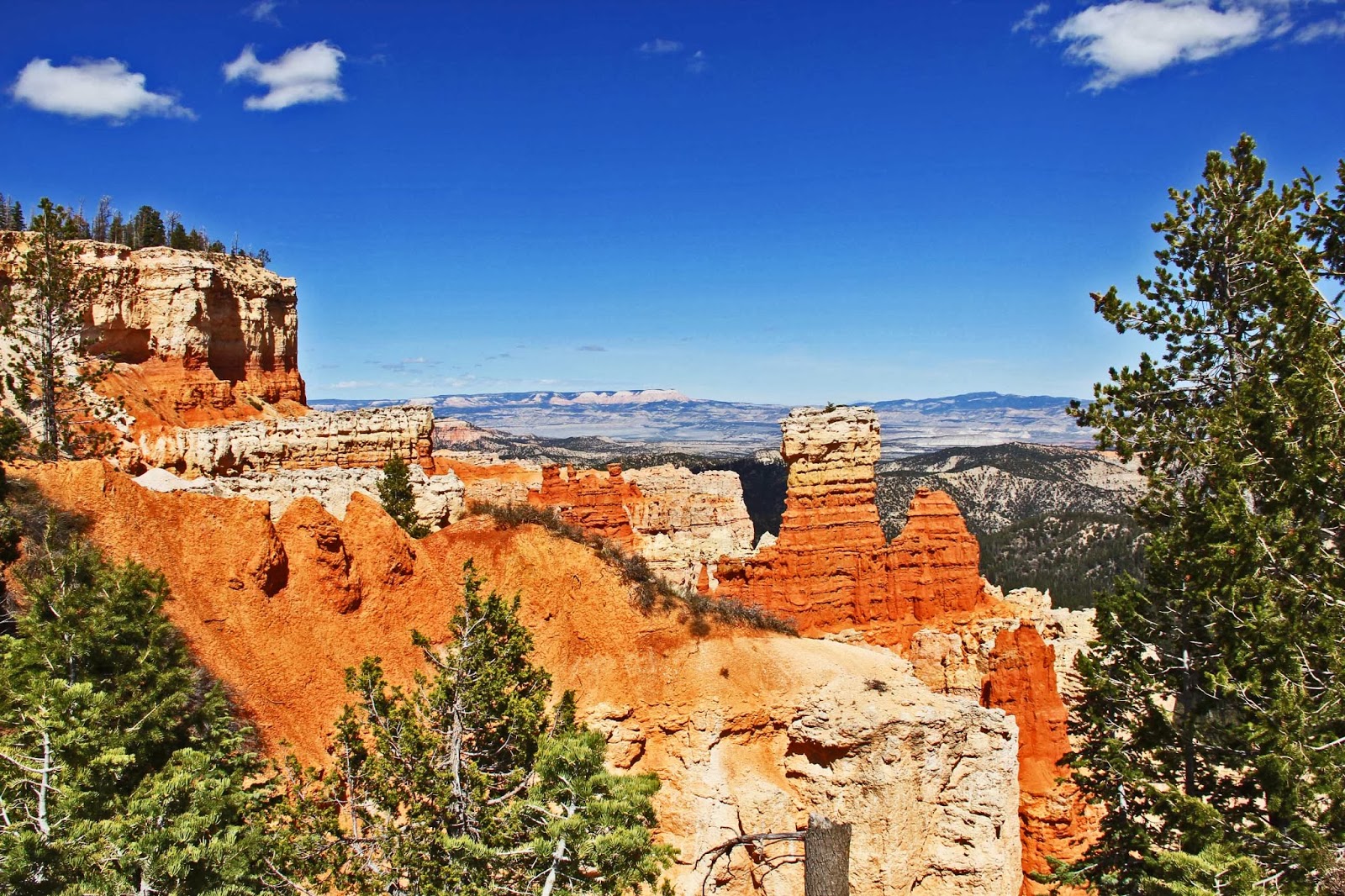
Upon arriving at
Bryce Canyon National Park we began our drive to the view points. The park is on a plateau over looking the "canyon" with those beautiful geological formations called hoodoos. Although it is called a canyon, it is technically not a canyon but a collection of giant natural amphitheaters along the eastern side of the
Paunsaugunt Plateau. This park, as with others, is outstandingly beautiful and well worth the trip. We spent a lot of time at each stop gazing at the hoodoos and the abundant colors of the landscape.
 |
| Hoodoo formation. |
With our brains in overload from all the eye candy we had taken in today we started back to our RV. We back tracked on Rt. 89 and bypassed the road through Zion taking another route that did not take us into the mountains. This particular route, a county road #43, took us by the
Coral Pink Sand Dunes State Park. The park is named for its fine reddish sand blown from the erosion of pink-colored
Navajo Sandstone surrounding the park.
 |
| Pinkish sand (well it looks pink in real life) of the Pink Coral Sand Dunes State Park |
All was going well on this route until we crossed the state line into Arizona and the pavement turned to dirt/sand. Uh-oh! Did not count on this. Bad thing about a GPS and maps. The GPS does not tell you if the road is paved or not and not all maps are accurate about the road type. We were too far into this to turn back so we charged on.
The road condition was terrible in places with washboarded fine sand that slowed us to a crawl. There were several places that the sand was so fine and powdery we almost got stuck. It took us almost 45 minutes to do the slightly less than 10 miles of this road before it turned back to pavement. Another adventure under our belts.
Tomorrow will be a down day before we move on to our next destination, Las Vegas. We have been moving fast for the past week and a half and we are all a bit tired. We'll be spending three weeks at the Nellis AFB RV Park and making it a combination rest/maintenance/sight-seeing stop.
Remember, if you click on a picture it will bring up all the pictures in a full screen format.